1. Introduction
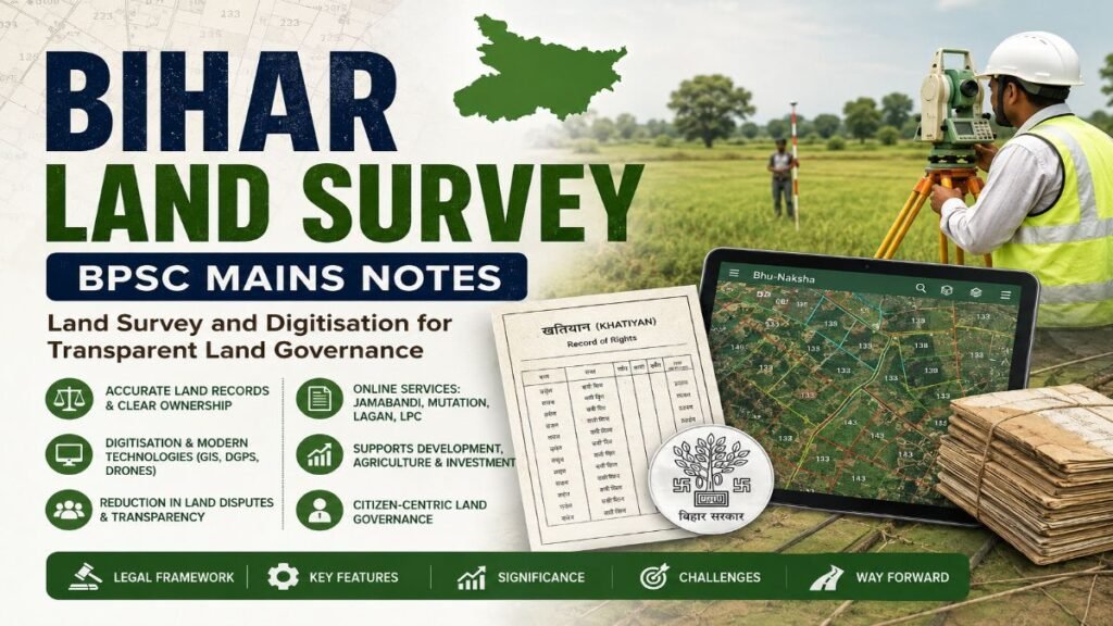
The Bihar Land Survey and Digitisation refer to the systematic process of identifying, measuring, mapping and digitally recording land parcels to establish accurate ownership, boundaries and land records. In Bihar, this process is being carried out under the Bihar Special Survey and Settlement Programme, implemented by the Department of Revenue and Land Reforms (DoRLR) to replace outdated land records with modern, technology-enabled and legally authenticated records. The programme seeks to create an integrated digital land management system that ensures transparency, reduces disputes and improves the efficiency of land administration.
The legal framework for this initiative is provided by the Bihar Special Survey and Settlement Act, 2011 and the Bihar Special Survey and Settlement Rules, 2012. The survey is being conducted using modern technologies such as Differential Global Positioning System (DGPS), Electronic Total Station (ETS), Geographic Information System (GIS), drone surveys and digital cadastral mapping to prepare updated Record of Rights (RoR/Khatiyan) and geo-referenced land maps.
The need for a fresh land survey in Bihar arose because most of Bihar’s land records were prepared during the Cadastral Survey (CS) and Revisional Survey (RS) conducted several decades ago. Over time, changes due to inheritance, sale, partition and encroachments made many records inaccurate, resulting in frequent land disputes, delays in mutation and challenges in revenue administration. Through digitisation, the state aims to establish a transparent, citizen-centric and technology-driven land governance system that supports economic development, infrastructure projects, agricultural reforms and the objectives of the Digital India Land Records Modernization Programme (DILRMP).
Master Current Affairs. Ace BPSC Mains.
BPSC Mains Current Affairs & International Relations Course
Master GS Paper-I (Section-II) with 116 exam-oriented topics, 5 structured lessons and downloadable PDF notes—all in one comprehensive course.
✔ 116 Exam-Oriented Topics • ✔ 5 Comprehensive Lessons • ✔ Downloadable PDF Notes • ✔ Updated for 72nd BPSC Mains
2. Why in News?
- The Bihar Government has extended the Bihar Special Survey and Settlement Programme till 31 March 2027, approving ₹1,078.87 crore and continuation of 16,012 survey-related posts to expedite the Bihar Land Survey and digitisation.
- The Revenue and Land Reforms Department is strengthening AI-enabled revenue administration, GIS-based monitoring and digital map modules to improve the accuracy and efficiency of land records.
- The state launched the Rajaswa Maha Abhiyan to help citizens correct errors in digitised Jamabandi, mutation and other land records through village-level camps and online platforms, improving transparency and accessibility.
- The programme continues to be a key component of Bihar’s Digital Land Governance reforms under the Digital India Land Records Modernization Programme (DILRMP), with ongoing integration of survey, registration and online land record services.
3. Key Features of Bihar Land Survey
- Comprehensive Legal Framework: The programme is implemented under the Bihar Special Survey and Settlement Act, 2011 and the Bihar Special Survey and Settlement Rules, 2012, ensuring legal validity of updated land records.
- Preparation of Updated Record of Rights (RoR): Fresh Khatiyan (Record of Rights) is prepared after verification of ownership, possession and land boundaries, replacing outdated records.
- Use of Modern Survey Technologies: The Bihar Land Survey employs DGPS, Electronic Total Station (ETS), GIS, drone surveys, satellite imagery and geo-referenced digital cadastral mapping for accurate land measurement.
- End-to-End Digital Survey Process: Includes self-declaration by landowners, field verification, draft publication, disposal of objections and final publication of updated land records.
- Digitisation of Land Records: Integration of Jamabandi, mutation, land maps (Bhu-Naksha), Bhu-Abhilekh, online Lagan, LPC and registration services on digital platforms for easy citizen access.
- Integration with DILRMP: The programme is aligned with the Digital India Land Records Modernization Programme (DILRMP) to establish a transparent, paperless and technology-driven land administration system.
- GIS-Based Land Governance: Digital cadastral maps are linked with ownership records, enabling better land-use planning, infrastructure development, disaster management and revenue administration.
- Citizen-Centric Service Delivery: Provides online access to land records, map downloads, mutation applications, revenue payment and grievance redressal, reducing delays and improving transparency.
Prepare Smarter. Study Better. Ace BPSC Mains.
BPSC Mains GS Paper 1 & 2 Complete Course
Access comprehensive BPSC Mains Notes for GS Paper 1 & 2, covering 378+ topics across 24 PDF lessons, with dedicated Bihar coverage, practice questions and downloadable study material.
✓ GS Paper 1 & 2 • ✓ 378+ Topics • ✓ 24 PDF Lessons • ✓ Bihar-Specific Coverage • ✓ Downloadable Notes
4. Significance of Bihar Land Survey
Transparent and Efficient Land Governance
- Creates accurate and legally authenticated land records.
- Reduces corruption and increases transparency in land administration.
- Strengthens e-governance through digital record management.
Reduction in Land Disputes
- Clearly demarcates land boundaries and ownership.
- Minimises disputes arising from outdated or incorrect land records.
- Facilitates faster disposal of land-related cases.
Improved Revenue Administration
- Enables timely mutation, collection of land revenue (Lagan) and issuance of Land Possession Certificates (LPC).
- Enhances efficiency of the Revenue and Land Reforms Department.
Promotes Economic Development
- Clear land titles improve access to institutional credit for farmers.
- Facilitates land acquisition for infrastructure, industries and public projects.
- Improves the Ease of Doing Business in Bihar.
Supports Agricultural Development
- Ensures secure land ownership, encouraging farmers to invest in modern agriculture.
- Assists in implementing schemes related to irrigation, crop insurance, PM-KISAN and other agricultural programmes.
Better Planning and Disaster Management
- GIS-enabled digital maps support urban planning, rural development and infrastructure projects.
- Helps identify flood-prone, erosion-prone and encroached areas for better disaster preparedness.
Strengthens Digital Governance
- Supports the Digital India Land Records Modernization Programme (DILRMP) by integrating survey, registration and land record services on a single digital platform.
- Improves citizen access to online land-related services and grievance redressal.
5. Major Achievements and Recent Developments
- 100% Digitisation of Cadastral Maps: Bihar has successfully digitised 1,35,865 cadastral maps, providing a strong foundation for GIS-based land administration and online land services.
- Progress in Special Survey: The Bihar Land Survey under the Bihar Special Survey and Settlement Programme is underway across the state, with 661 revenue villages having their final Record of Rights (RoR) notified under the new survey.
- Integration of Registration and Land Records: All 137 Sub-Registrar Offices (SROs) have been integrated with digital land records, enabling faster registration, mutation and verification of land ownership.
- Expansion of Online Citizen Services: Platforms such as Bhu-Abhilekh, Bhu-Naksha, online Jamabandi, online Mutation, Lagan payment and LPC services have significantly improved transparency and ease of access to land records.
- Financial and Institutional Support: The programme has been extended till 31 March 2027 with an approved outlay of ₹1,078.87 crore and continuation of 16,012 survey-related posts to ensure timely completion of the land survey in Bihar.
- Citizen-Centric Reforms: Initiatives such as the Rajaswa Maha Abhiyan and Revenue Helpline have been launched to rectify errors in digitised land records and improve grievance redressal at the village level.
6. Challenges
Outdated and Incomplete Legacy Records
- Many land records are based on old Cadastral Survey (CS) and Revisional Survey (RS) records that no longer reflect the actual ownership and boundaries.
- Errors in legacy records delay the preparation of updated Record of Rights (RoR).
Land Ownership and Boundary Disputes
- Disputes arising from inheritance, partition, encroachments and unclear boundaries complicate the Bihar Land Survey process.
- Disposal of objections during draft publication often takes considerable time.
Administrative and Technical Constraints
- Shortage of trained survey personnel and technical experts.
- Difficult terrain, dense habitations and inaccessible areas slow field surveys.
Digital and Public Awareness Challenges
- Limited digital literacy and awareness among rural citizens regarding online land services.
- Many landowners face difficulties in submitting self-declarations and accessing digital platforms.
Delay in Survey Completion
- Survey and final publication of updated land records are progressing gradually across districts.
- Delays affect mutation, land transactions and implementation of development projects.
Coordination and Data Integration Issues
- Effective coordination is required among the Revenue Department, Registration Department, local bodies and other stakeholders.
- Continuous updating and synchronisation of digital records remain a major challenge.
7. Way Forward
- Complete the Special Survey in a Time-Bound Manner: Ensure timely completion of the Bihar Special Survey and Settlement Programme with adequate financial and human resources.
- Strengthen Digital Land Governance: Expand the use of GIS, drones, AI and satellite imagery for accurate, real-time and tamper-proof land records.
- Improve Public Awareness and Accessibility: Conduct village-level awareness campaigns and strengthen Common Service Centres (CSCs) to help citizens access digital land services.
- Enhance Institutional Capacity: Recruit and train more survey personnel, GIS experts and revenue officials to improve the speed and quality of implementation.
- Strengthen Grievance Redressal: Establish fast-track mechanisms for resolving objections, boundary disputes and errors in digitised land records.
- Ensure Seamless Data Integration: Integrate land survey, registration, mutation, revenue collection and court records into a unified digital platform for efficient land administration.
- Promote Regular Updating of Land Records: Move towards continuous updation of land records through online mutation and periodic verification to keep ownership records accurate.
- Leverage Central Government Support: Strengthen convergence with the Digital India Land Records Modernization Programme (DILRMP) to accelerate digitisation, improve service delivery and achieve transparent, citizen-centric land governance.
Experience the Quality Before You Enroll
Download Free Sample Notes (PDF)
Download a free sample of our BPSC Mains Current Affairs Notes and experience the structured, exam-oriented content before enrolling. Explore the presentation, answer-writing approach, and overall quality of the complete course.
✔ Free Download • ✔ Exam-Oriented Notes • ✔ Updated Content • ✔ Structured for BPSC Mains
BPSC Mains Practice Question
Q1. Land survey and digitisation are essential for ensuring transparent land governance and sustainable development in Bihar. Critically examine the significance of the Bihar Special Survey and Settlement Programme. Also discuss the major challenges in its implementation and suggest suitable measures to address them.
Learn More from the Department of Revenue and Land Reforms, Government of Bihar
Readers interested in the Bihar Land Survey, land survey in Bihar, land record digitisation, the Bihar Special Survey and Settlement Programme, and digital land governance can visit the official website of the Department of Revenue and Land Reforms (DoRLR), Government of Bihar. The portal provides authentic information on land surveys, online land records, Bhu-Naksha, Jamabandi, mutation services, revenue administration, and citizen-centric digital land services.