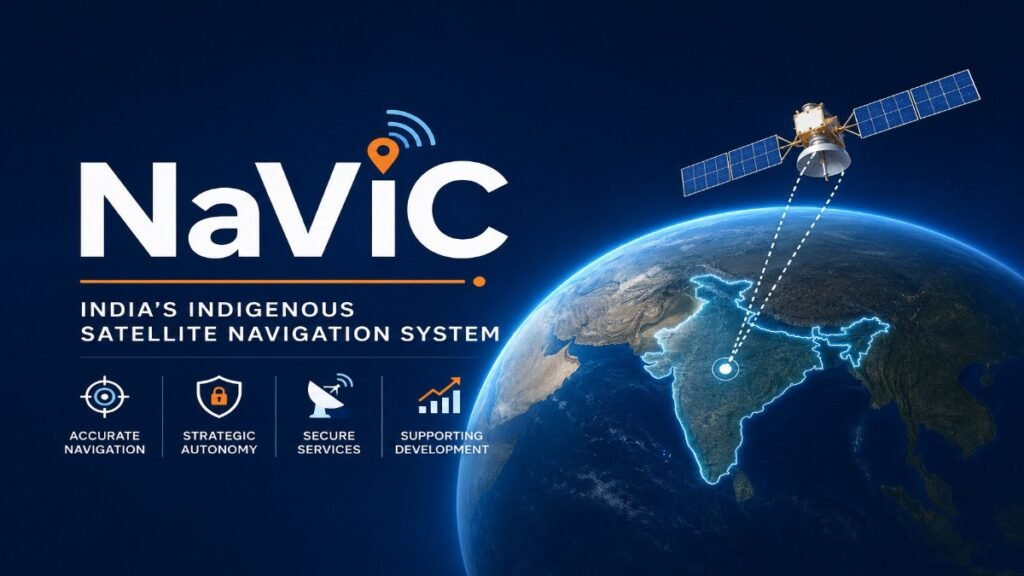
NaVIC (Navigation with Indian Constellation)
1. Introduction
NaVIC (Navigation with Indian Constellation) is India’s indigenous regional satellite navigation system, developed by the Indian Space Research Organisation (ISRO) to provide accurate Position, Navigation and Timing (PNT) services. It was earlier known as the Indian Regional Navigation Satellite System (IRNSS) and was renamed NaVIC to reflect its role as India’s own navigation system.
NaVIC was developed to ensure that India has an independent and reliable navigation capability, reducing dependence on foreign systems such as the United States’ GPS, Russia’s GLONASS, Europe’s Galileo and China’s BeiDou. The importance of such an indigenous system became evident during the 1999 Kargil War, when India reportedly faced difficulties in obtaining high-precision GPS data for military operations. This highlighted the need for a sovereign NaVIC Satellite System under India’s control.
The NaVIC constellation is designed with 7 core satellites, comprising 3 Geostationary Orbit (GEO) satellites and 4 Inclined Geosynchronous Orbit (IGSO) satellites, supported by an extensive network of ground stations across the country. It provides navigation services over India and a region extending about 1,500 km beyond its borders, with a positioning accuracy better than 20 metres and timing accuracy better than 40–50 nanoseconds in its primary service area. NaVIC Navigation System offers two categories of services:
- Standard Positioning Service (SPS): An open navigation service available for civilian users.
- Restricted Service (RS): An encrypted, high-accuracy navigation service meant for authorised users such as the Armed Forces and strategic agencies.
To modernise the system, ISRO has initiated the second-generation NaVIC (NVS series). The NVS-01 satellite, launched in May 2023, carries India’s first indigenous space-qualified atomic clock, while the new-generation satellites also broadcast navigation signals in the L1 band, improving compatibility with smartphones and other commercial navigation devices. The NVS-02 satellite was launched in January 2025 as part of this modernisation programme.
Today, NaVIC has become a strategic national asset supporting transportation, disaster management, defence, fisheries, surveying, telecommunications and Digital India, while strengthening India’s technological self-reliance under the vision of Atmanirbhar Bharat. These NaVIC System BPSC Notes provide a comprehensive understanding of India’s indigenous navigation system and are highly useful for BPSC Mains and other competitive examinations.
Master Science & Technology. Maximize Your BPSC Mains Score.
Enroll in the BPSC Science & Tech Course Today
Master Science & Technology for BPSC Mains GS Paper-2 with 75+ exam-oriented topics, 6 structured lessons, and downloadable PDF notes—all in one course.
✔ 75+ Exam-Oriented Topics • ✔ 6 Comprehensive Lessons • ✔ Downloadable PDF Notes • ✔ Updated for 72nd BPSC Mains
2. How NaVIC Works
NaVIC works through a constellation of satellites in space and a network of ground stations in India. The satellites continuously transmit navigation signals, which are received by NaVIC-enabled devices such as smartphones, vehicle navigation systems and specialised receivers. By analysing signals from multiple satellites, the receiver accurately determines its location, direction, speed and time.
The NaVIC Satellite System consists of 7 core satellites supported by ground control stations that monitor satellite health, maintain accurate timing and ensure reliable navigation services. To strengthen the system, ISRO has started deploying the second-generation NVS satellites, which offer improved accuracy, longer operational life and better compatibility with modern navigation devices. NaVIC Navigation System provides two types of navigation services:
- Standard Positioning Service (SPS): An open service available to civilians for applications such as road navigation, disaster management, fisheries and mobile-based location services.
- Restricted Service (RS): An encrypted, high-precision service available only to authorised users, including the Indian Armed Forces and strategic agencies, for defence and national security operations.
Unlike global navigation systems that provide worldwide coverage, NaVIC is specifically designed to deliver high-accuracy navigation over India and up to about 1,500 km beyond its borders, making it particularly suitable for regional applications and strategic requirements. These concepts form an important part of NaVIC System BPSC Notes as they explain the working mechanism and unique features of India’s indigenous navigation system.
3. Applications of NaVIC
Transportation and Navigation
NaVIC provides accurate positioning and navigation services for road, rail, air and maritime transport. It is used for route navigation, fleet management, vehicle tracking and traffic monitoring, improving transportation efficiency and safety. Through integration with GAGAN, NaVIC Navigation System also enhances aircraft navigation and supports safer flight operations. The Government of India has mandated AIS-140 compliant public transport vehicles (such as buses carrying school children and hazardous goods) to be equipped with NaVIC-compatible vehicle tracking devices.
Defence and National Security
The Restricted Service (RS) of NaVIC provides encrypted, high-precision navigation exclusively to authorised agencies, including the Indian Armed Forces. It supports border surveillance, troop movement, missile guidance, naval operations and secure military communication. As an indigenous NaVIC Satellite System, it ensures uninterrupted navigation during emergencies without relying on foreign satellite navigation systems.
Disaster Management and Emergency Response
NaVIC plays a vital role in disaster preparedness by supporting cyclone tracking, flood monitoring, search and rescue operations and emergency communication. Accurate location information helps disaster management agencies quickly locate affected areas, coordinate rescue teams and deliver relief materials. It also supports India’s disaster early warning systems for coastal and vulnerable regions.
Agriculture, Fisheries and Resource Management
NaVIC supports precision agriculture by enabling accurate field mapping, farm machinery guidance and efficient resource utilisation. In the fisheries sector, it is integrated with advisories issued by agencies such as INCOIS (Indian National Centre for Ocean Information Services) to guide fishermen towards Potential Fishing Zones (PFZs) and provide alerts about rough sea conditions, thereby improving income and enhancing safety at sea.
Governance, Digital Services and Everyday Applications
NaVIC is increasingly being integrated into smartphones, vehicle navigation systems, logistics, surveying, mapping and digital governance platforms. It supports applications such as location-based services, emergency response, asset tracking and infrastructure planning. With the introduction of L1-band signals in the second-generation NVS satellites, compatibility with commercial smartphones and navigation devices is expected to increase significantly, promoting wider adoption of NaVIC in daily life.
These wide-ranging applications demonstrate that NaVIC has evolved beyond a navigation tool into a strategic national infrastructure supporting economic development, public service delivery and national security. The practical applications of the NaVIC Navigation System are frequently asked in competitive examinations and therefore form an important part of NaVIC System BPSC Notes.
Experience the Quality Before You Enroll
Download Free Sample Notes (PDF)
Download a free sample of our BPSC Mains Science & Technology Notes and experience the structured, exam-oriented content before enrolling. Explore the presentation, answer-writing approach, and overall quality of the complete course.
✔ Free Download • ✔ Exam-Oriented Notes • ✔ Updated Content • ✔ Structured for BPSC Mains
4. Significance and Advantages of NaVIC
- Strengthens India’s Strategic Autonomy: NaVIC provides India with an indigenous and independent navigation system, eliminating dependence on foreign systems such as GPS (USA), GLONASS (Russia), Galileo (European Union) and BeiDou (China). This ensures uninterrupted navigation services during emergencies, conflicts or geopolitical crises.
- High Accuracy over India: Unlike global navigation systems that provide uniform worldwide coverage, the NaVIC Satellite System is specifically designed for the Indian region, offering positioning accuracy better than 20 metres over India and up to 1,500 km beyond its borders. This makes it highly reliable for civilian as well as strategic applications.
- Supports National Development: NaVIC contributes to flagship initiatives such as Digital India, PM Gati Shakti, Smart Cities Mission and intelligent transportation systems by enabling accurate mapping, logistics management, infrastructure planning and efficient delivery of public services.
- Enhances National Security: The encrypted Restricted Service (RS) provides secure navigation for the Armed Forces, supporting border surveillance, maritime security, missile guidance and defence operations. Indigenous control over the NaVIC Navigation System prevents disruption of critical navigation services during national emergencies.
- Boosts Economic Growth and Innovation: NaVIC promotes the growth of India’s space industry, start-ups and electronics manufacturing by encouraging the development of indigenous navigation devices, vehicle tracking systems, drones and location-based applications. It also aligns with the objectives of Atmanirbhar Bharat and the Indian Space Policy, 2023.
- Foundation for Future Technologies: The deployment of the second-generation NVS satellites, equipped with L1-band signals and indigenous atomic clocks, is expanding the compatibility of NaVIC with smartphones, autonomous vehicles, drones and Internet of Things (IoT) applications. This will accelerate the adoption of advanced navigation technologies across multiple sectors.
Thus, NaVIC has emerged as a strategic national asset that not only strengthens India’s technological self-reliance but also supports governance, economic development, innovation and national security. These advantages make the topic an important component of NaVIC System BPSC Notes, and questions related to the significance of the NaVIC Satellite System are frequently asked in BPSC Mains and other competitive examinations.
5. Challenges
- Limited Coverage: Unlike global navigation systems such as GPS and Galileo, NaVIC currently provides regional coverage over India and about 1,500 km beyond its borders, limiting its use for global navigation.
- Limited Adoption: Although the Government has promoted NaVIC integration, its adoption in smartphones, commercial navigation devices and automobile systems remains limited compared to GPS. Wider availability of NaVIC-compatible chipsets is still evolving.
- Infrastructure and Awareness: Greater investment is required in receiver manufacturing, application development and user awareness to encourage widespread utilisation of the NaVIC Navigation System across various sectors.
- Satellite Maintenance: Maintaining uninterrupted navigation services requires timely replacement of ageing satellites and continuous upgradation of the ground segment to ensure high accuracy and reliability of the NaVIC Satellite System.
These challenges indicate that while NaVIC has established itself as India’s indigenous navigation system, its full potential can be realised only through wider commercial adoption, continuous technological upgrades and stronger industry participation. Addressing these issues is essential for expanding the role of NaVIC in transportation, governance, defence and digital services. These aspects are also important from the perspective of NaVIC System BPSC Notes for BPSC Mains and other competitive examinations.
6. Future Prospects
- Expansion through Second-generation NVS Satellites: ISRO is deploying the NVS series with improved L1-band navigation signals, indigenous atomic clocks and enhanced service life to improve the accuracy of NaVIC and its compatibility with smartphones and commercial navigation devices.
- Integration with Emerging Technologies: NaVIC is expected to play a key role in autonomous vehicles, drones, the Internet of Things (IoT), smart cities, precision agriculture and intelligent transportation systems, supporting India’s digital transformation.
- Greater Role in Governance and Disaster Management: Wider integration of the NaVIC Navigation System into vehicle tracking, emergency response, logistics, fisheries, disaster warning systems and infrastructure planning will improve governance, public service delivery and disaster preparedness.
- Strengthening India’s Space Economy: With increasing adoption by industry, start-ups and government agencies, the NaVIC Satellite System is expected to become a key component of India’s growing geospatial and navigation ecosystem, supporting the vision of Atmanirbhar Bharat, Digital India and Viksit Bharat 2047.
The future of NaVIC lies in its widespread integration across transportation, defence, governance and emerging digital technologies. As satellite modernisation and commercial adoption continue to expand, NaVIC is expected to become a globally recognised indigenous navigation system, strengthening India’s technological self-reliance and contributing significantly to the country’s digital and economic growth. These future developments make NaVIC System BPSC Notes highly relevant for BPSC Mains and other competitive examinations.
7. Conclusion
NaVIC has emerged as a strategic national asset that has strengthened India’s technological self-reliance in satellite navigation. Developed by ISRO, the NaVIC Satellite System provides reliable Position, Navigation and Timing (PNT) services for transportation, defence, disaster management, agriculture, fisheries, governance and numerous location-based applications. Its indigenous nature ensures uninterrupted navigation support while reducing India’s dependence on foreign navigation systems.
With the deployment of second-generation NVS satellites, improved compatibility with smartphones and expanding adoption across government and commercial sectors, NaVIC is poised to become an integral part of India’s transportation, governance, defence and digital infrastructure. As India advances towards Atmanirbhar Bharat and Viksit Bharat 2047, the NaVIC Navigation System will continue to play a crucial role in strengthening the country’s scientific, strategic and economic development. These NaVIC System BPSC Notes provide a comprehensive understanding of India’s indigenous satellite navigation programme and are highly valuable for BPSC Mains and other competitive examinations.
Learn More from ISRO:
Readers interested in learning more about NaVIC, its satellite constellation, navigation services, NVS satellites, Position, Navigation and Timing (PNT) capabilities, and the latest developments in India’s indigenous navigation programme can visit the official website of the Indian Space Research Organisation (ISRO). The website provides authentic information on the NaVIC Satellite System, mission updates, technical features, and its applications in transportation, disaster management, defence and digital governance.
BPSC Mains Practice Questions
Q1. Discuss the features, working mechanism and applications of NaVIC. How does India’s indigenous satellite navigation system contribute to strategic autonomy, national security and socio-economic development?
Q2. Examine the significance of NaVIC as India’s indigenous satellite navigation system. Discuss its major challenges and future prospects in the context of Digital India, intelligent transportation systems and Atmanirbhar Bharat.