Use of Space Technology for Development of India
1. Introduction
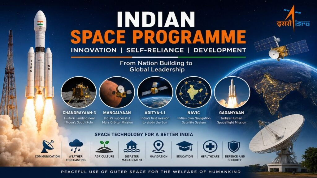
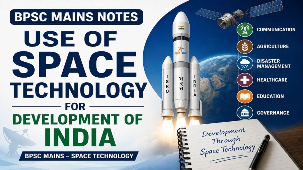
Use of Space Technology for Development of India refers to the application of satellites, launch vehicles, spacecraft and related systems to explore space and provide services that improve the quality of life on Earth. Today, space technology plays a crucial role in communication, navigation, weather forecasting, agriculture, disaster management, resource mapping and national security.
India has adopted a development-centric approach to its space programme since the establishment of the Indian Space Research Organisation (ISRO) in 1969. Guided by the vision of Dr. Vikram Sarabhai, India’s space programme has focused on using space technology to solve socio-economic challenges rather than limiting it to scientific exploration. Over the years, Use of Space Technology for Development of India has become an essential pillar for promoting inclusive growth, improving governance, strengthening disaster resilience and supporting national initiatives such as Digital India, Atmanirbhar Bharat and Viksit Bharat 2047.
Today, India is recognised as one of the world’s leading space-faring nations, with cost-effective space missions and a rapidly expanding space ecosystem involving both the government and the private sector. These Space Technology BPSC Notes provide a comprehensive understanding of the Use of Space Technology for Development of India and are highly useful for BPSC Mains Space Technology preparation.
Master Science & Technology. Maximize Your BPSC Mains Score.
Enroll in the BPSC Science & Tech Course Today
Master Science & Technology for BPSC Mains GS Paper-2 with 75+ exam-oriented topics, 6 structured lessons, and downloadable PDF notes—all in one course.
✔ 75+ Exam-Oriented Topics • ✔ 6 Comprehensive Lessons • ✔ Downloadable PDF Notes • ✔ Updated for 72nd BPSC Mains
2. Components of Space Technology
Space technology comprises a network of satellites, launch systems, ground infrastructure and data-processing facilities that work together to deliver a wide range of services. Each component performs a specific function and collectively supports communication, navigation, Earth observation, scientific research and socio-economic development. Understanding these components is essential to appreciate the Use of Space Technology for Development of India.
Major Components of Space Technology
- Communication Satellites: Facilitate television broadcasting, telecommunication, internet connectivity, telemedicine, tele-education and emergency communication. India primarily uses the GSAT satellite series for these services.
- Earth Observation (Remote Sensing) Satellites: Capture high-resolution images and geospatial data of the Earth’s surface for applications such as agriculture, water resource management, urban planning, forestry, mineral exploration and disaster management. Major Indian satellites include the Resourcesat, Cartosat and Oceansat series.
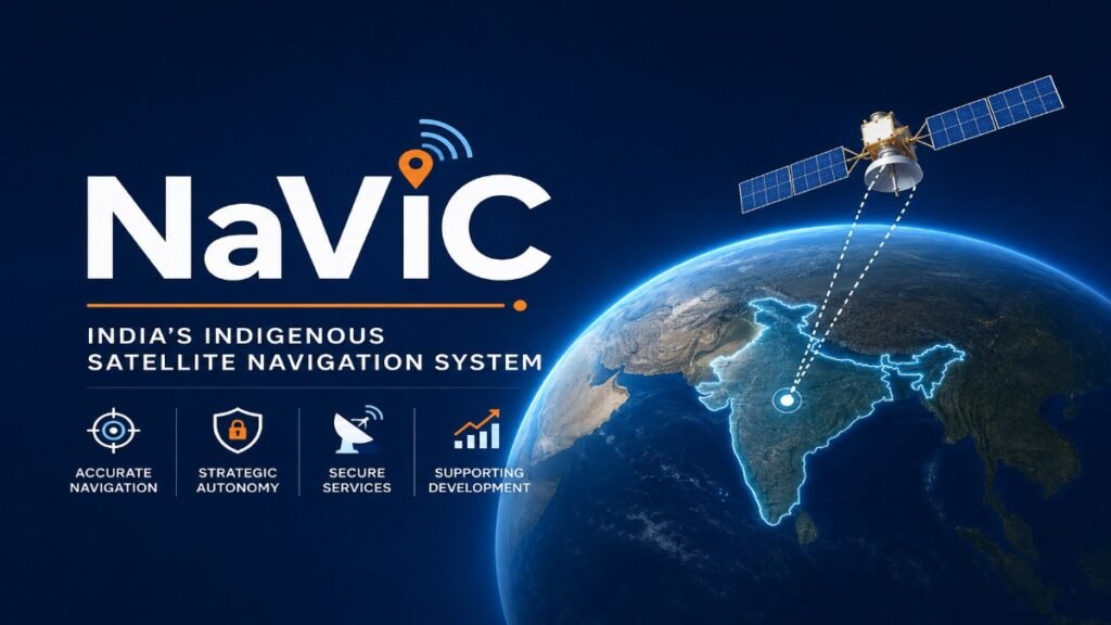
- Navigation Satellites: Provide accurate Position, Navigation and Timing (PNT) services for transportation, defence, disaster response and location-based applications. India’s regional navigation system is NavIC (Navigation with Indian Constellation).
- Meteorological Satellites: Monitor weather conditions, cyclones, rainfall, cloud movement and climate patterns to improve weather forecasting and early warning systems. The INSAT and GISAT series play an important role in meteorological observations.
- Scientific and Exploration Satellites: Used for planetary exploration, space science and astronomical research. Missions such as Chandrayaan, Mangalyaan and Aditya-L1 have significantly enhanced India’s scientific capabilities.
- Launch Vehicles and Ground Infrastructure: Launch vehicles such as PSLV, GSLV, LVM3 and SSLV place satellites into their designated orbits, while ground stations receive, process and distribute satellite data for various civilian and strategic applications.
Together, these components form the backbone of India’s space ecosystem and enable the effective Use of Space Technology for Development of India across multiple sectors. For aspirants, understanding these fundamentals forms the basis of Space Technology BPSC Notes, as questions in BPSC Mains Space Technology frequently assess the applications and significance of different space-based systems rather than merely testing factual knowledge.
Experience the Quality Before You Enroll
Download Free Sample Notes (PDF)
Download a free sample of our BPSC Mains Science & Technology Notes and experience the structured, exam-oriented content before enrolling. Explore the presentation, answer-writing approach, and overall quality of the complete course.
✔ Free Download • ✔ Exam-Oriented Notes • ✔ Updated Content • ✔ Structured for BPSC Mains
3. Role of Space Technology in Communication and Digital Connectivity
Communication satellites have revolutionised the way people communicate, access information and receive essential services across India. Since India’s vast geographical diversity includes remote villages, mountainous regions, islands and border areas where terrestrial communication infrastructure is difficult to establish, satellite-based communication provides reliable and uninterrupted connectivity. Today, satellites form an important backbone of India’s digital infrastructure by supporting television broadcasting, telecommunications, internet services, banking, education, healthcare and disaster communication. This is one of the most significant examples of the Use of Space Technology for Development of India.
Satellite Communication
Communication satellites receive, amplify and retransmit signals between different locations on Earth. India’s GSAT satellite series provides communication services through C-band, Extended C-band, Ku-band and S-band transponders, enabling nationwide coverage. Satellite communication is especially useful in regions where laying optical fibre cables is technically difficult or economically unviable.
Television Broadcasting
Satellite technology has transformed television broadcasting in India. National broadcasters like Doordarshan and hundreds of private television channels use communication satellites to transmit programmes across the country. Direct-to-Home (DTH) services such as Tata Play, Airtel Digital TV and Dish TV receive television signals directly from satellites, allowing people in remote villages, islands and hilly regions to access educational, entertainment and news channels without dependence on cable networks.
A family living in a remote village of Arunachal Pradesh or the Andaman & Nicobar Islands can watch live cricket matches, educational programmes and government announcements through DTH services even in the absence of cable infrastructure.
Telecommunication and Internet Connectivity
Communication satellites play a vital role in providing voice, data and internet connectivity, particularly in rural, tribal and border regions. They act as backup communication systems during natural disasters when terrestrial mobile towers and optical fibre networks are damaged. Satellite communication also supports Very Small Aperture Terminal (VSAT) networks, which connect banks, government offices, defence establishments, ATMs, oil and gas installations, educational institutions and remote research stations.
Many bank ATMs located in remote areas of Ladakh, the North-East and Himalayan regions operate through VSAT technology, ensuring uninterrupted banking services even where conventional internet connectivity is unreliable.
Telemedicine and Digital Healthcare
Space technology has significantly improved healthcare accessibility through telemedicine, which enables doctors in specialised hospitals to diagnose and advise patients located hundreds of kilometres away using satellite communication. This reduces travel costs, saves time and ensures timely medical consultation for people living in remote and underserved regions.
ISRO initiated India’s telemedicine programme by connecting urban super-speciality hospitals with rural hospitals and health centres. Today, satellite communication complements digital healthcare initiatives such as eSanjeevani, especially in geographically difficult areas.
A patient from a remote village in the Himalayan region can receive consultation from specialists at AIIMS or other tertiary hospitals without travelling long distances.
Tele-education and Digital Learning
Satellite technology has expanded access to quality education by connecting schools, colleges and training institutions across the country. India’s dedicated education satellite EDUSAT pioneered satellite-based education, enabling interactive classrooms, teacher training and distance learning programmes. Even today, satellite communication supports online education, educational television channels and digital learning platforms in areas with limited terrestrial connectivity.
Students preparing for competitive examinations in remote districts can access lectures broadcast through educational channels and digital platforms supported by satellite communication. This application is frequently covered in Space Technology BPSC Notes because it demonstrates how satellites contribute directly to inclusive development.
Support to Digital Governance
Satellite communication strengthens e-Governance by ensuring reliable connectivity for government offices, police stations, border outposts and public service centres located in remote regions. It facilitates digital delivery of government services, secure communication during emergencies and efficient implementation of welfare schemes.
Thus, communication satellites have become an indispensable component of India’s digital ecosystem by bridging the urban-rural digital divide, improving service delivery and promoting inclusive socio-economic development. The Use of Space Technology for Development of India in the communication sector clearly illustrates how space technology has become an engine of digital transformation, making this topic highly relevant for BPSC Mains Space Technology preparation.
4. Role of Space Technology in Agriculture and Rural Development
Agriculture remains the backbone of the Indian economy, supporting nearly half of the country’s workforce. Space technology has emerged as a powerful tool for improving agricultural productivity, ensuring food security and promoting sustainable rural development. By using remote sensing satellites, navigation systems and Geographic Information Systems (GIS), farmers, policymakers and scientists can make informed decisions regarding crop planning, irrigation, soil management and disaster mitigation. This demonstrates the growing Use of Space Technology for Development of India in the agricultural sector.
Crop Monitoring and Production Estimation
Earth Observation satellites continuously monitor crop conditions, crop health and cropping patterns across the country. High-resolution satellite imagery helps estimate crop acreage, predict production and assess damage caused by droughts, floods or pest attacks. This information enables the government to formulate procurement policies, manage food stocks and provide timely assistance to farmers.
The FASAL (Forecasting Agricultural Output using Space, Agro-meteorology and Land-based Observations) programme uses satellite data along with weather and field observations to estimate the production of major crops such as wheat, rice, cotton and sugarcane. Before the wheat procurement season, satellite-based crop estimation helps the government assess expected production and plan procurement through agencies like the Food Corporation of India (FCI).
Precision Agriculture
Precision agriculture involves applying inputs such as water, fertilisers and pesticides only where they are needed. Satellite imagery and NavIC-based positioning help farmers identify variations in crop health, soil moisture and nutrient deficiency, thereby reducing production costs and increasing crop yields.
A farmer can identify water-stressed portions of a field through satellite-based advisory services instead of irrigating the entire farm, resulting in water conservation and lower electricity costs.
Soil and Water Resource Management
Satellite-based mapping assists in identifying soil types, groundwater potential, watershed areas and irrigation requirements. These inputs support efficient water resource management and scientific planning of irrigation projects. Space technology is also extensively used in monitoring watershed development programmes and river basin management.
Satellite maps help government agencies identify suitable locations for constructing check dams, farm ponds and rainwater harvesting structures in drought-prone districts.
Drought Assessment and Crop Insurance
Satellite observations enable early detection of drought conditions by monitoring rainfall, vegetation health and soil moisture. These assessments support timely relief measures and improve the implementation of agricultural insurance schemes such as the Pradhan Mantri Fasal Bima Yojana (PMFBY) by providing objective evidence of crop damage.
When crops are damaged due to prolonged drought or floods, satellite imagery helps verify the extent of loss, making compensation claims faster and more transparent.
Fisheries and Rural Livelihoods
Satellite data helps identify Potential Fishing Zones (PFZs) by analysing sea surface temperature and chlorophyll concentration. These advisories enable fishermen to locate fish-rich areas more efficiently, reducing fuel consumption, saving time and increasing their income.
Fishermen along the eastern and western coasts receive PFZ advisories through mobile applications, allowing them to reach productive fishing areas quickly instead of searching randomly in the sea.
Rural Development and Natural Resource Planning
Space technology supports programmes related to watershed development, rural road planning, land use mapping and village resource management. Geospatial information is increasingly being used in schemes such as MGNREGA, watershed projects and infrastructure planning to ensure better utilisation of natural resources and transparent implementation of development programmes.
Thus, by integrating satellite data with agriculture, water management and rural planning, the Use of Space Technology for Development of India has become an indispensable tool for enhancing farmers’ income, ensuring food security and promoting sustainable rural development. These applications are frequently discussed in Space Technology BPSC Notes because they demonstrate how space technology directly contributes to inclusive growth and rural transformation, making them highly relevant for BPSC Mains Space Technology.
5. Role of Space Technology in Weather Forecasting, Climate Monitoring and Disaster Management
India is highly vulnerable to natural disasters such as cyclones, floods, droughts, landslides, earthquakes and forest fires. Space technology has significantly enhanced the country’s ability to monitor weather systems, predict disasters, issue timely warnings and coordinate relief operations. Satellites provide continuous, real-time information over vast geographical areas, enabling authorities to minimise loss of life and property. This is another important dimension of the Use of Space Technology for Development of India.
Weather Forecasting
Meteorological satellites continuously observe cloud formation, rainfall patterns, atmospheric temperature, humidity, wind movement and sea surface conditions. The INSAT and GISAT satellite series provide critical data to the India Meteorological Department (IMD) for preparing short-term and long-term weather forecasts.
Accurate weather information benefits millions of farmers, fishermen, airline operators and disaster management agencies. Farmers use weather forecasts to decide the appropriate time for sowing, irrigation and harvesting, while fishermen receive advisories regarding rough sea conditions before venturing into the ocean.
Cyclone Monitoring and Early Warning
India has made remarkable progress in cyclone prediction through satellite-based observations. Continuous monitoring of cloud systems, sea surface temperature and wind patterns enables scientists to accurately predict the intensity, path and landfall of cyclones several days in advance. This has substantially reduced casualties during major cyclones.
For example, timely satellite-based warnings during Cyclone Fani (2019), Cyclone Amphan (2020) and Cyclone Biparjoy (2023) enabled the evacuation of lakhs of people from vulnerable coastal regions, preventing large-scale loss of human lives.
Flood Monitoring
Remote sensing satellites monitor river water levels, flood inundation, reservoir conditions and drainage patterns in near real time. During floods, satellite imagery helps identify submerged villages, damaged infrastructure and safe evacuation routes. Agencies such as the National Remote Sensing Centre (NRSC) regularly provide flood maps to the National Disaster Management Authority (NDMA), the Ministry of Home Affairs and State Disaster Management Authorities.
Satellite-based flood maps also assist relief agencies in planning rescue operations and distributing food, medicines and other essential supplies efficiently.
Drought Monitoring
Space technology plays a crucial role in assessing drought conditions by analysing vegetation cover, rainfall distribution and soil moisture. Satellite-derived indices enable governments to identify drought-affected districts at an early stage and implement relief measures such as water supply, fodder distribution and financial assistance to farmers. Such assessments also support agricultural planning and the implementation of crop insurance schemes by providing objective evidence of crop stress.
Forest Fire Monitoring
Satellites equipped with thermal sensors can detect active forest fires within a short time of their occurrence. The Forest Survey of India (FSI) uses satellite-based monitoring systems to issue near real-time fire alerts to State Forest Departments, enabling rapid response and reducing damage to forests and wildlife habitats.
Landslide and Earthquake Assessment
Although satellites cannot predict earthquakes, they play a significant role in assessing post-disaster damage. High-resolution satellite images help identify landslide-prone areas, damaged roads, blocked rivers and affected settlements after earthquakes or heavy rainfall. This information assists authorities in prioritising rescue operations and restoring connectivity.
In Himalayan states, satellite monitoring of glacial lakes and unstable mountain slopes also helps identify areas vulnerable to Glacial Lake Outburst Floods (GLOFs) and landslides.
Climate Change and Environmental Monitoring
Space technology provides long-term data on glaciers, snow cover, sea level rise, deforestation, desertification, air quality and coastal erosion. Such observations are essential for understanding the impacts of climate change and formulating effective adaptation and mitigation strategies. Satellite data also supports national programmes related to carbon monitoring, biodiversity conservation and sustainable natural resource management.
Thus, by providing accurate, timely and reliable information, the Use of Space Technology for Development of India has transformed disaster preparedness from a reactive approach to a proactive system based on early warning, scientific planning and efficient disaster response. These applications are an integral part of Space Technology BPSC Notes and are frequently asked in BPSC Mains Space Technology because they demonstrate the role of space technology in protecting lives, livelihoods and the environment.
6. Role of Space Technology in Infrastructure, Resource Management and Urban Planning
Space technology has become an indispensable tool for infrastructure planning, natural resource management and sustainable urban development. High-resolution satellite imagery, remote sensing and Geographic Information System (GIS) enable governments to map land resources, monitor environmental changes and plan developmental projects with greater accuracy. This not only reduces project costs and implementation time but also promotes scientific and evidence-based decision-making. It is another significant example of the Use of Space Technology for Development of India.
Land Use and Urban Planning
Remote sensing satellites provide accurate information on land use and land cover, helping planners identify agricultural land, forests, water bodies, industrial zones and urban settlements. This information is extensively used in preparing city master plans, expanding urban infrastructure and preventing unplanned urbanisation.
Satellite-based geospatial data also supports the Smart Cities Mission, ensuring efficient planning of roads, drainage systems, public utilities and green spaces while reducing encroachment on environmentally sensitive areas.
Infrastructure Development
Space technology assists in planning and monitoring major infrastructure projects such as highways, railways, airports, ports, pipelines and industrial corridors. Satellite imagery helps identify the most suitable alignment by considering terrain, environmental impact and population distribution, thereby reducing construction costs and project delays.
The PM Gati Shakti National Master Plan integrates geospatial data from multiple departments to improve infrastructure planning and coordination, making project implementation faster and more efficient.
Water Resource Management
Satellite observations help monitor rivers, reservoirs, lakes, groundwater recharge zones and irrigation networks. They support river basin planning, reservoir management and identification of water-stressed regions, enabling efficient utilisation of water resources.
Remote sensing is also used to monitor watershed development projects, groundwater recharge structures and interlinking of rivers. Such information assists policymakers in addressing water scarcity and ensuring sustainable water management.
Forest and Biodiversity Conservation
Space technology enables continuous monitoring of forest cover, deforestation, afforestation and biodiversity-rich regions. Satellite imagery helps detect illegal encroachments, forest degradation and changes in vegetation over time. The Forest Survey of India (FSI) regularly uses satellite data to prepare the India State of Forest Report (ISFR), which serves as an important reference for forest conservation policies.
Mineral and Energy Resource Exploration
Remote sensing techniques help identify mineral-bearing formations, geological structures and potential mining zones before detailed field investigations are undertaken. This reduces exploration costs and minimises environmental disturbance.
Satellite data is also increasingly used in identifying suitable locations for renewable energy projects such as solar parks and wind farms by assessing solar radiation, wind patterns and land suitability.
Coastal and Marine Resource Management
India’s vast coastline requires continuous monitoring for coastal erosion, shoreline changes, mangrove conservation and marine resource management. Satellites help identify vulnerable coastal zones, monitor oil spills and assess the impact of cyclones and sea-level rise.
Satellite-based ocean observations also support the sustainable management of marine ecosystems and strengthen the country’s Blue Economy initiatives.
Geospatial Governance
Modern governance increasingly depends on geospatial technologies for planning, monitoring and evaluation of developmental programmes. Platforms such as ISRO’s Bhuvan Geoportal provide satellite-based maps and spatial information for ministries, state governments and local bodies. These platforms improve transparency, facilitate real-time monitoring and support evidence-based policymaking across sectors.
Thus, the Use of Space Technology for Development of India has transformed infrastructure development, resource management and urban planning by providing accurate geospatial information, enabling sustainable planning and improving the efficiency of public investment. These topics form an important part of Space Technology BPSC Notes because they demonstrate the practical application of space technology in governance and development, making them highly relevant for BPSC Mains Space Technology.
7. Role of Space Technology in Navigation, Transportation and Strategic Sectors
Space technology has significantly enhanced navigation, transportation efficiency and national security by providing accurate Position, Navigation and Timing (PNT) services. Satellite-based navigation systems support road, rail, air and maritime transport, while also strengthening border management, defence operations and emergency response. India’s indigenous navigation capabilities have reduced dependence on foreign satellite systems and improved strategic autonomy. This highlights the growing Use of Space Technology for Development of India in both civilian and strategic sectors.
Navigation Services
India has developed its own regional satellite navigation system, NavIC (Navigation with Indian Constellation), which provides accurate Position, Navigation and Timing (PNT) services over India and surrounding regions. NavIC offers greater reliability for civilian users and provides encrypted services for authorised agencies.
NavIC is increasingly being integrated into smartphones, vehicle tracking systems, marine navigation and emergency response services. It is particularly useful during natural disasters when uninterrupted navigation becomes critical.
Road Transportation
Satellite-based navigation has transformed road transport by enabling real-time route guidance, traffic monitoring and fleet management. Navigation applications use satellite positioning to provide the shortest routes, estimate travel time and identify traffic congestion.
Public transport agencies, logistics companies and emergency services utilise satellite-based tracking to improve operational efficiency. The transport of goods through e-commerce platforms, courier services and fuel tankers is also monitored using GPS and NavIC-enabled vehicle tracking systems.
Railways
Indian Railways is increasingly adopting satellite navigation for train tracking, passenger information systems and operational management. Real-time location data improves train scheduling, enhances passenger safety and enables better management of railway assets.
Satellite communication also supports railway operations in remote regions where conventional communication networks may be unreliable.
Civil Aviation
Space technology has greatly improved aviation safety through GAGAN (GPS Aided GEO Augmented Navigation), a satellite-based augmentation system jointly developed by ISRO and the Airports Authority of India (AAI). GAGAN enhances the accuracy of aircraft navigation, enabling safer take-off, en-route navigation and landing, especially under poor weather conditions.
Its implementation has reduced fuel consumption, shortened flight routes, improved airspace utilisation and enhanced overall aviation safety.
Maritime Navigation
Satellite navigation enables ships to determine precise positions, optimise sailing routes and improve maritime safety. Fishing vessels also benefit from satellite-based navigation and weather advisories, allowing fishermen to avoid rough sea conditions and reach potential fishing zones more efficiently.
The integration of NavIC with marine navigation has strengthened coastal surveillance, search and rescue operations and the safety of fishermen operating along India’s coastline.
Defence and Border Management
Space technology is a critical component of India’s national security architecture. Satellites provide secure communication, surveillance, reconnaissance and navigation support to the Armed Forces. High-resolution Earth observation satellites monitor border infrastructure, troop movement and strategic assets, while navigation satellites assist in the precise movement of defence personnel, aircraft, ships and missiles.
Satellite imagery has become invaluable for monitoring sensitive border regions, coastal areas and the Indian Ocean Region, thereby enhancing India’s defence preparedness and maritime security.
Emergency Response and Search & Rescue
During disasters and emergencies, satellite navigation helps locate affected areas, guide rescue teams and coordinate relief operations. Ambulances, disaster response teams and emergency vehicles use satellite navigation to reach disaster sites quickly, reducing response time and improving rescue efficiency.
Thus, the Use of Space Technology for Development of India has transformed transportation systems, strengthened national security and improved public safety through reliable satellite-based navigation and communication services. These applications are an important part of Space Technology BPSC Notes and are frequently covered in BPSC Mains Space Technology because they demonstrate the strategic as well as developmental significance of India’s space capabilities.
8. Role of Space Technology in Healthcare, Education and Governance
Space technology has played a transformative role in improving access to healthcare, education and public services, particularly in remote, rural and underserved regions of India. By integrating satellite communication, remote sensing and geospatial technologies, the government has enhanced service delivery, reduced regional disparities and strengthened evidence-based governance. This reflects the expanding Use of Space Technology for Development of India across the social sector.
Healthcare and Telemedicine
Satellite communication has enabled telemedicine, allowing patients in remote areas to consult specialist doctors located in urban hospitals without travelling long distances. This has significantly improved healthcare accessibility in hilly regions, tribal areas and islands where specialist medical facilities are limited.
ISRO launched its Telemedicine Programme in 2001, initially connecting Apollo Hospital, Chennai, with a rural hospital in Andhra Pradesh. Over the years, the network expanded to connect super-speciality hospitals, district hospitals and remote health centres across the country.
Today, telemedicine complements the Government’s eSanjeevani platform, one of the world’s largest telemedicine services. By 2026, eSanjeevani has facilitated over 40 crore teleconsultations, making healthcare more accessible and affordable for millions of citizens. Satellite communication is also used for:
- Continuing Medical Education (CME) for doctors.
- Remote diagnosis through tele-radiology and tele-pathology.
- Emergency medical consultation during natural disasters.
Education and Distance Learning
Space technology has revolutionised distance education by enabling high-quality educational content to reach students irrespective of their geographical location. India launched EDUSAT (GSAT-3) in 2004, the country’s first satellite dedicated exclusively to education. It supported:
- Virtual classrooms.
- Teacher training programmes.
- Interactive learning.
- School and university education.
- Technical and vocational education.
Although EDUSAT has completed its operational life, its legacy continues through satellite-supported digital education platforms such as SWAYAM, SWAYAM Prabha DTH Channels, DIKSHA Portal and PM eVIDYA, especially in areas where internet connectivity remains limited.
During the COVID-19 pandemic, satellite television channels under SWAYAM Prabha ensured uninterrupted learning for students who lacked access to smartphones or broadband internet. This application is frequently highlighted in Space Technology BPSC Notes because it demonstrates the role of space technology in promoting inclusive education.
Governance and Public Service Delivery
Space technology has become an important tool for good governance by providing accurate, real-time and location-specific information for planning, implementation and monitoring of government programmes.
ISRO’s Bhuvan Geoportal, India’s indigenous geospatial platform, provides satellite imagery, thematic maps and GIS-based services to various ministries and state governments. It supports planning and monitoring in sectors such as:
- Rural development.
- Agriculture.
- Urban planning.
- Water resources.
- Infrastructure.
- Disaster management.
Several flagship government programmes increasingly utilise geospatial technology, including:
- PM Gati Shakti National Master Plan for integrated infrastructure planning.
- SVAMITVA Scheme, which uses drone surveys and geospatial technology to prepare property cards in rural areas.
- Jal Jeevan Mission for planning rural water supply infrastructure.
- MGNREGA, where satellite imagery helps monitor watershed development and rural assets.
- Digital India, which relies on satellite communication to extend digital services to remote regions.
Disaster Governance and Emergency Response
Satellite-based communication ensures uninterrupted coordination among government agencies during emergencies when terrestrial communication networks fail. Real-time satellite imagery enables authorities to identify affected areas, monitor relief operations and allocate resources efficiently.
During floods, cyclones and landslides, agencies such as the National Disaster Management Authority (NDMA), National Remote Sensing Centre (NRSC) and State Disaster Management Authorities rely extensively on satellite-derived information for rescue and rehabilitation.
Geospatial Decision Support
The Government increasingly uses geospatial technologies for evidence-based policymaking. Satellite data supports:
- Monitoring of crop conditions.
- Identification of encroachments.
- Land record modernisation.
- Environmental impact assessment.
- Smart city planning.
- Monitoring of forests, wetlands and water bodies.
Such applications have improved transparency, reduced implementation delays and enabled better utilisation of public resources.
Thus, the Use of Space Technology for Development of India has strengthened healthcare, education and governance by connecting hospitals, classrooms and government institutions through space-based infrastructure. These applications are an integral part of BPSC Mains Space Technology and are widely covered in Space Technology BPSC Notes because they illustrate how space technology contributes directly to inclusive development, digital governance and efficient public service delivery.
9. Recent Developments in India’s Space-based Development Ecosystem
India’s space sector has undergone a major transformation in recent years through policy reforms, increased private sector participation and the adoption of advanced technologies. These developments have expanded the role of space technology from a government-led scientific programme to a dynamic ecosystem supporting innovation, economic growth and national development. This reflects the evolving Use of Space Technology for Development of India in the era of commercialisation and technological self-reliance.
Indian Space Policy, 2023
The Indian Space Policy, 2023 provides a comprehensive framework for promoting private sector participation while redefining the roles of various space institutions. The policy aims to make India a major player in the global space economy by encouraging innovation, commercialisation and international collaboration. Key objectives include:
- Expanding the participation of non-government entities.
- Enhancing satellite manufacturing and launch services.
- Promoting research and innovation.
- Increasing India’s share in the global space economy.
- Strengthening public-private partnerships.
IN-SPACe
The Indian National Space Promotion and Authorization Centre (IN-SPACe) acts as an autonomous regulatory body that facilitates and authorises the participation of private companies in the space sector. It provides access to ISRO’s infrastructure, technical expertise and testing facilities, enabling start-ups and industries to develop satellites, launch vehicles and space-based applications.
NewSpace India Limited (NSIL)
NewSpace India Limited (NSIL), the commercial arm of the Department of Space, is responsible for commercialising ISRO’s technologies and promoting space-based services. It facilitates satellite launches, technology transfer, satellite manufacturing and the marketing of launch services to domestic and international customers.
Growth of India’s Space Start-up Ecosystem
India’s private space ecosystem has witnessed rapid growth in recent years. According to IN-SPACe, more than 300 space start-ups are now engaged in areas such as satellite manufacturing, launch vehicles, Earth observation, satellite communication, geospatial analytics and space-based applications. Leading start-ups include:
- Skyroot Aerospace – India’s first private company to successfully launch the Vikram-S rocket.
- Agnikul Cosmos – Developer of the world’s first single-piece 3D-printed rocket engine and the Agnibaan launch vehicle.
- Pixxel – Building one of the world’s largest commercial hyperspectral satellite constellations for Earth observation.
- Dhruva Space – Developing small satellites and satellite platforms.
- Digantara – Working on space situational awareness and space debris monitoring.
These companies are contributing to employment generation, technological innovation and the growth of India’s space economy.
Expansion of NavIC
India is expanding the capabilities of NavIC (Navigation with Indian Constellation) by integrating it into smartphones, vehicle navigation systems, disaster management, maritime services and public transportation. The government has also encouraged smartphone manufacturers to support NavIC-compatible chipsets, reducing dependence on foreign navigation systems.
Space Technology Supporting National Development
Recent initiatives have further integrated space technology into flagship government programmes such as:
- PM Gati Shakti National Master Plan for infrastructure planning.
- Digital India for improving digital connectivity.
- Smart Cities Mission through geospatial planning.
- SVAMITVA Scheme for rural property mapping.
- Jal Jeevan Mission and watershed development through satellite-based monitoring.
- Climate resilience and sustainable resource management through advanced Earth observation systems.
These developments demonstrate that the Use of Space Technology for Development of India is evolving from a scientific endeavour into a key driver of innovation, economic growth, governance and sustainable development. These recent initiatives are regularly featured in Space Technology BPSC Notes and are highly relevant for BPSC Mains Space Technology, particularly from the perspective of current affairs and government policy.
10. Conclusion
The Use of Space Technology for Development of India has emerged as a powerful instrument for socio-economic transformation by strengthening communication, agriculture, disaster management, navigation, governance, healthcare and education. India’s development-oriented space programme has successfully demonstrated that investments in space technology not only advance scientific capabilities but also improve the quality of life of millions of people through better public services, efficient resource management and informed policymaking.
With continuous technological advancements, supportive policy reforms and growing private sector participation, India is leveraging space technology not only for scientific achievements but also for inclusive development and national security. As the country progresses towards the vision of Viksit Bharat 2047, the Use of Space Technology for Development of India will remain a strategic pillar for sustainable growth, technological self-reliance and improving the quality of life of its citizens. These Space Technology BPSC Notes provide a comprehensive understanding of the developmental applications of space technology and serve as valuable study material for BPSC Mains Space Technology.
Learn More from ISRO:
Readers interested in exploring how space technology supports communication, agriculture, disaster management, navigation, healthcare, education, governance and sustainable development in India can visit the official website of the Indian Space Research Organisation (ISRO). The website provides authentic information on Indian satellites, remote sensing applications, navigation systems, Earth observation missions, launch vehicles, space policies and the latest initiatives demonstrating the Use of Space Technology for Development of India.
BPSC Mains Practice Questions
Q1. “Space technology has become a catalyst for inclusive socio-economic development in India.” Discuss the Use of Space Technology for Development of India with suitable examples from communication, agriculture, disaster management, healthcare, education and governance.
Q2. Examine the role of space technology in strengthening agriculture, weather forecasting, disaster management and natural resource management in India. How has satellite-based technology improved evidence-based planning and sustainable development?
Q3. Discuss the recent developments in India’s space-based development ecosystem. Highlight the significance of the Indian Space Policy, 2023, IN-SPACe, NSIL and private sector participation in promoting innovation, economic growth and the developmental use of space technology.